
Sidney to Leechtown
via Lochside & Galloping Goose Trails 2022
After a hearty breakfast the next day at Mom's Cafe in downtown (actually, uptown from where I was staying!) Sooke, I rode back to where I had left the Goose the day before. I started out on the quiet trail and after about a 1.5km ride, near the 45km trail marker, I came to the Charters Trestle over the Charters River - This steel trestle was originally built in 1918 and recently refurbished with wood and timber decking - very impressive.


Two kilometres farther along the trail was another even more awesome high trestle to ride and cross over Todd Creek. The Todd Creek Trestle was closed in 2017 as it was found to be in a run-down and dangerous state owing to rotting support timbers. Funds were garnered to the amount of over $1.5 million in order to restore the historic 1918 structure. After the extensive repairs were completed, the trestle reopened in 2020 and it is a sight to behold as an outstanding example of a timber railway trestle.
A fine job of restoration that should garner the trestle another fifty years of useful life.


to Todd Creek
Very close by, at the west of the trail, Sooke River Rd. winds its way to the Sooke Potholes Provincial Park where vehicles and recreationalists can access the parking lots and campground areas of the park. During the Summer months, the potholes and river are a very popular area with natural pools and opportunities for hiking, climbing, swimming etc. When riding the trail alongside the river potholes there are many scenic views of the river and rocky areas below.


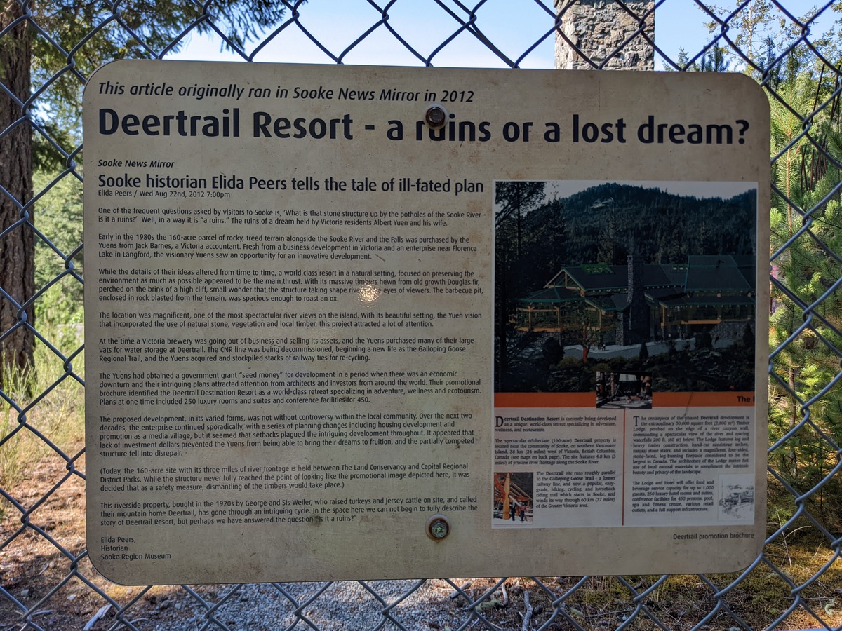
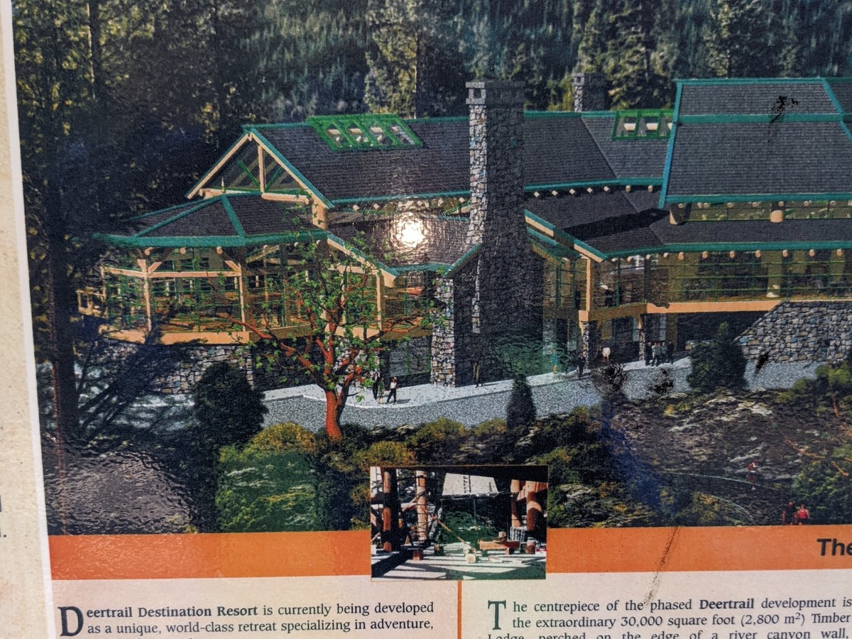
Adjacent to one of the parking lots is the historic Barnes Station Shelter (unfortunately with some idiot's graffiti) named after the pre-1980 owner of the 160-acre property. In 1980, the land was purchased by Albert Yuen, who had a dream of building an ambitious
" Deertrail Destination Resort and Media Village."
The dream did not realise, and the property went into foreclosure to end up as the parkland that it is today.

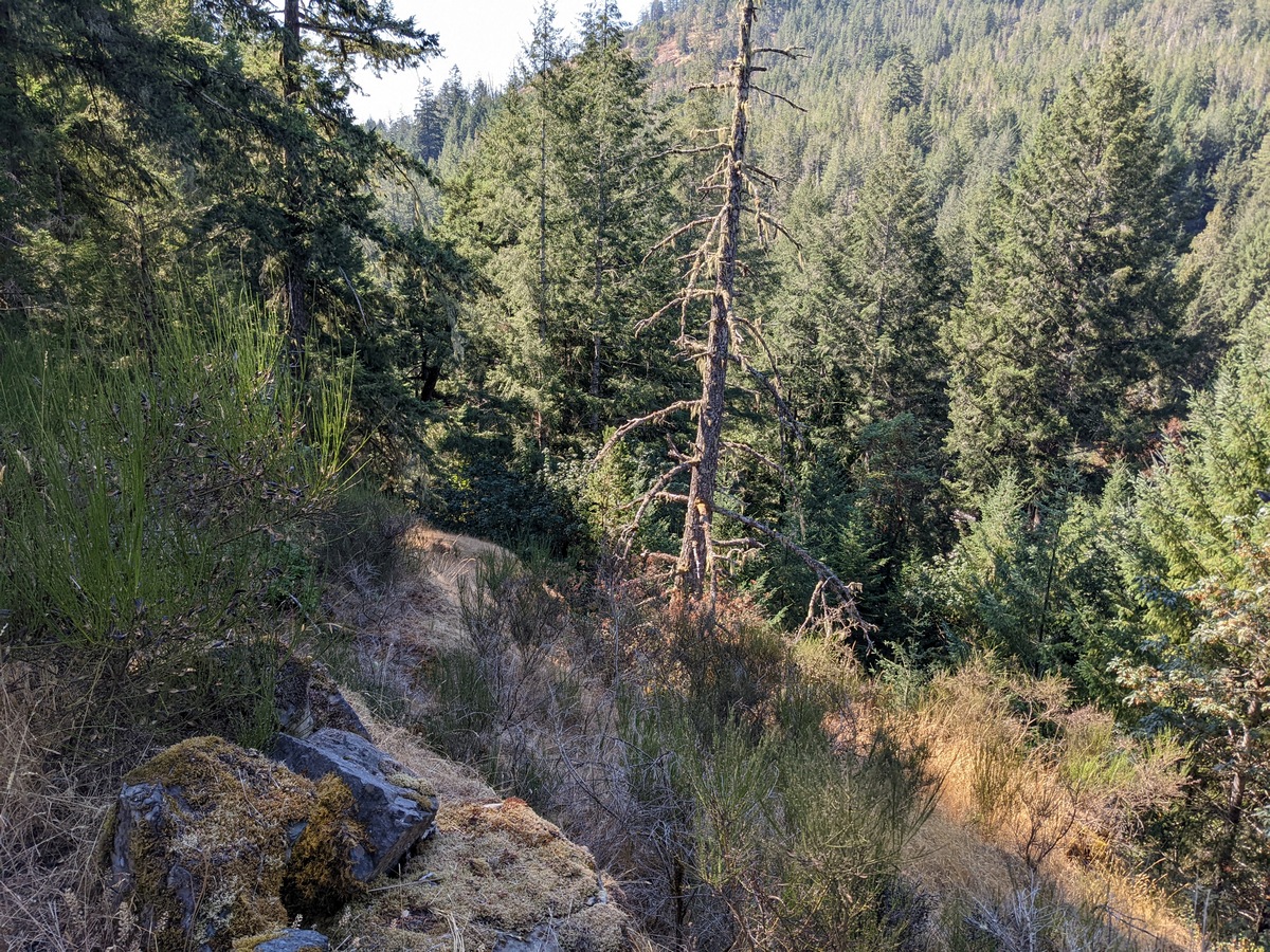
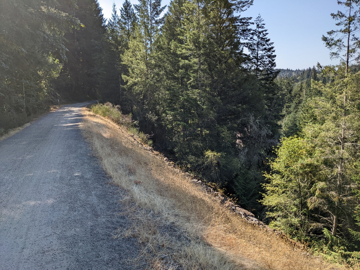
Beyond the ruins, the trail peacefully meanders on alongside the Sooke River with peak-a-boo views downward to the river and adjacent landscape. Some very steep grades next to the trail in this area may create an unplanned adventure if too much time is spent rubbernecking while riding!
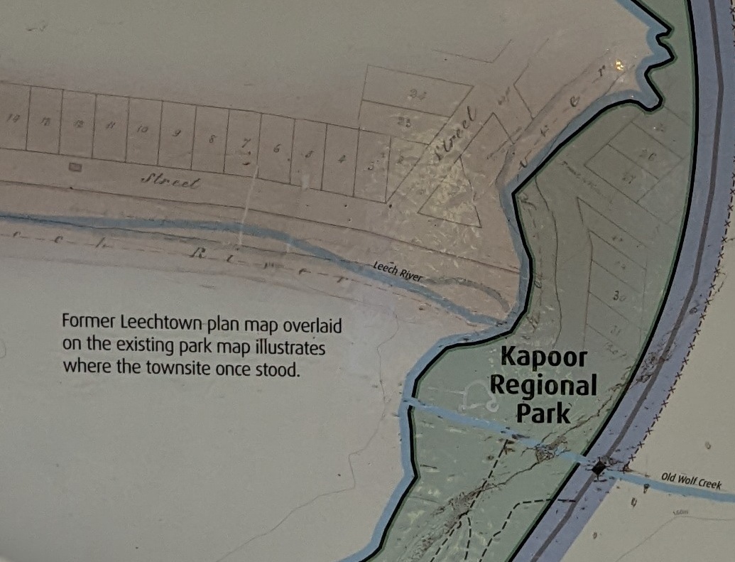
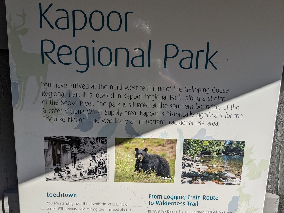
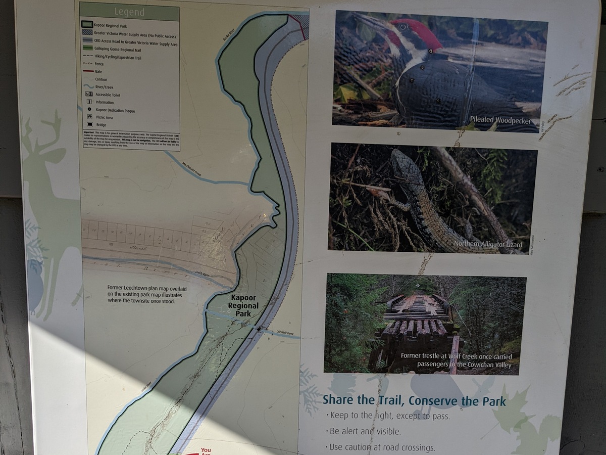
The 55km post is the official terminus of the Galloping Goose Trail and the site of the former location of Leechtown. The area is now Kapoor Regional Park which has a washroom and a rest area with picnic tables. The first and last photos below shows, as an overlay, where the former town was located in relation to the park...
Although this was the terminus of the Goose, I could see that the trail obviously carries on for a distance and I was compelled to continue riding to see what was now beyond Kapoor Park/Leechtown in the present day.
So back to the beginning story of my travels to this area in 1996...
When I reached this area there was a small contingent of camper trucks, vans, tents etc. scattered on the riverbanks. They were obviously "wild camping" and had driven there via the Boneyard Main logging road. I rode on past them; the trail was now getting a little rougher and I reached a short broken-down trestle at Wolf Creek. Luckily it was a low trestle but only had sporadic old railway sleeper timbers, so I managed to gingerly walk the bike across, and then I could carry on riding from that point.
After about 2km from Leechtown, I reached a small barrier gate with no visual signs that warned me not to proceed. So, proceed I did around the gate (there was a path around) and rode on to reach the banks of Sooke Lake Reservoir. In 1996, the road adjacent to the lake was the Provincial (gravel) Highway 117, which I rode on for a short distance and then noticed some old telegraph poles on my right-hand side over a low ridge. I rode to investigate and realised that the poles were on the old CNoPR railway route right of way. As on the Goose, the rails had been removed so I managed to ride on the old railbed for quite a distance, before being forced to return to the 117 Highway due to the declining condition of the rail bed.
At the end of 117, I reached Sooke Lake Rd., then Shawnigan Lake Rd. at the south end of Shawnigan Lake. From there I accessed a decent trail (now the Cowichan Valley Trail - CVT) on west side of Shawnigan Lake all the way to Renfrew Rd.


Before Restoration
After Restoration
I crossed over Renfrew Rd., where I accessed another trail for a short distance before reaching the historic Kinsol Trestle over the Koksilah River - a truly massive structure, but in 1996 it was impassable (later restored in 2011 and now passable as part of the CVT). This was the end of my 1996 ride on the old rail beds, from then on, I rode back to find a campsite for the night. I made my home the next day via a road route and the ferry from Mill Bay that crosses the Saanich Inlet to Brentwood Bay.
NOTE: I discovered later that there was a bridge, "Burnt Bridge," crossing the river 5km upstream.
However, it had a formidable gate and would have required a great deal of effort to get the bike and camping gear past/over the gate together with a fair amount of bushwacking on the other side to find the CVT route to Cowichan Lake.
Back to the present day...

Although 55km is the posted length of the Galloping Goose Trail, after leaving the former Leechtown, I found this marker on the way north while trying to find the gate to my old route north in 1996 that I accessed.
Finally, I arrived at trail's end and instead of a flimsy excuse for a barrier that I encountered in 1996, there was this formidable gate with various warning signs that the watershed area is now a restricted area and closed to the general public.
Leaving the gate behind I returned on the trail back to my cabin in Sooke. The next day, I retraced my route along the trails back to my home in Sidney, BC.


So, there you have it, a bike ride own memory lane for me, taken 26 years after the first visit to the area! It was a fine trip with very good weather and most pleasing to see all the trestle and trail improvements made since 1996.
Summary
In 1998, the gravel that I rode in 1996 (Highway 117) was closed, as was the CNR right of way in order to increase public control over sensitive catchment lands and remove the greatest threats to Greater Victoria's water supply.
In 2002, the Sooke Lake Reservoir dam was raised by 6 metres allowing for an 80% increase in water volume. This raising of the dam flooded the surrounded lands; therefore Highway 117 and the old rail bed are submerged forever!
Riding my 1996 route next to Sooke Lake is obviously impossible today and access to the whole reservoir area is now highly restricted, so I'm glad that I was able to visit the area in it's infancy 26 years ago and prior to the raising of the resevoir's water level!
As the Goose/CNR railbed were part of Canada's Great Trail in the reservoir area, a new connecting route was developed through the Sooke Hills Wilderness Regional Park to span the gap that existed prior to the closures. The Sooke Hills Wilderness Trail now is the missing link; however, this is no gentle-grade rail trail and is quite rugged with some grades of 16%! Be warned!
Basil enjoyed the ride too, but wished he had a face mask as the trail was very dusty. I vacuumed him off when I got home; he wasn't too happy with that procedure!
Basil: "I asked for a bath and got vacuumed, typical! I wonder how he'd like that?"
Finis!
